Surveying, Pipeline Utility Locating and GIS Mapping
Overview
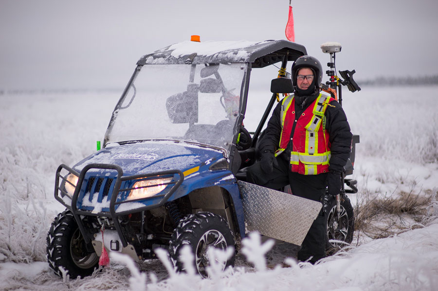
Our advanced technologies and expert use of geographical information and global positioning systems allow us to precisely pinpoint desired locations. Our GPS land surveying units can quickly identify locations with accuracy on the horizontal plane. Clean Harbors Surveying teams draw from over 20 years of industry experience. We have the advantage of highly trained professionals with the manpower to complete your project with efficiency.
Clean Harbors Surveying Solutions include:
- UnderCanopyGPS – software that provides accurate under-canopy GPS data collection
- GPS Survey Control – static GPS survey quality control
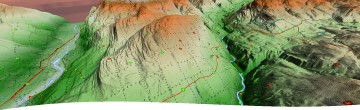
GIS Mapping
We can provide a wide range of GIS mapping. Using the most current software to manage and plot data, we can provide up-to-date maps for any project. Geo-referenced program data is visually represented in paper and digital maps format.
Pre-plot Mapping
- Lidar mapping is used to adjust point locations,
- Environmentally sensitive areas are identified,
- Source & Receiver points are remodeled to comply with regulated setbacks while meeting specified client requirements.
Receiver and Source Points
- Trimble GNSS receivers are used to establish and survey receiver and source points,
- Points can be moved as needed to accommodate terrain and/or environmental concerns,
- Final point locations are delivered to client representatives in various formats.
Pipeline Utility Locates
Clean Harbors Pipeline Utility Locators provide locating, GPS surveying, and GIS mapping of your underground utility and buried facility lines in advance of your ground disturbance activities. Our locators are also supported by pipeline database providers whose database searches are produced digitally and transmitted with ease.
Clean Harbors can fulfill your One-Call Management needs from start to finish while on the program including the placement of tickets, a liaison between project management and facility owner requirements, and confirmation from facility owners of locates and crossing.
Clean Harbors is experienced with Line Locating on Seismic Programs in Canada within Alberta, Saskatchewan, British Columbia and Manitoba, and in the U.S. within Pennsylvania, Colorado and Oklahoma.
- Seismic Locating
- GIS Mapping
- Crossing Inspection/Supervision
- Sign Installations
- Pipeline Integrity Programs