Seismic Services
Overview

Clean Harbors Seismic Services offer safety, expertise and the manpower to support even your most difficult seismic project.
We provide project management expertise to layout, cut, and survey source and receiver lines and perform seismic drilling. Our techniques maximize efficiencies and minimize environmental impact. From planning to equipment utilization, our experienced professionals deliver quality service—on time and on budget.
As the first Seismic Services company to apply quality control systems, our operating methods and progressive reporting ensures the highest standards to keep your project on track.
Comprehensive Project Management:
- Clean Harbors offers end-to-end project management for exploration services
- Our expertise ensures efficiency while minimizing environmental impact
Expertise in Seismic Drilling:
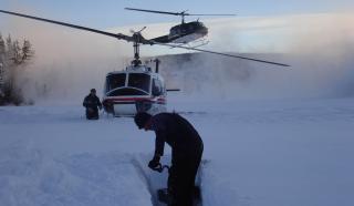
- Clean Harbors is a leader in heli-portable seismic drilling; they can access almost any site by air, land or a combination of both
- Our state-of-the-art drills prioritize safety, production and durability
Line Clearing Techniques:
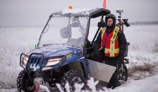
- We provide mulcher and hand-cut line clearing services using GPS-guided equipment to create precise lines with minimal disturbance
- Clean Harbors adheres to low-impact seismic cutting requirements
Advanced Surveying Methods:
- Prior to equipment hitting the ground, we provide line locating to ensure the program runs safely and smoothly
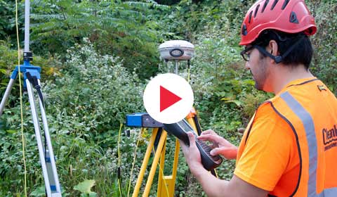
- Clean Harbors leverages GPS technology for line layout and surveying in forested areas; we preprogram positional data and achieve accurate horizontal positioning
- Lidar survey techniques allow efficient ground coverage, providing reliable vertical information for survey points
Seismic Drilling

Canada Seismic Drilling Services
Clean Harbors Seismic Drilling services focus on safety, quality and production. Our drills are user-friendly and lightweight, and give operators the air and power they need to maximize production. Liquid-cooled motors with pro-heat systems allow us to operate in temperatures as cold as -30C, with stand-alone pieces staying cool in the summer heat.
Heli-portable Drilling
Clean Harbors owns 6-heli crews each consisting of 7 drills and support equipment. Our heli-portable drills are mainly utilized on programs with restricted access such as river crossings, and steep terrain. These drills can also perform open or cased-hole soil sampling utilizing a split-spoon soil sampler.
Track Drilling
Our fleet of 56 low impact (LIS) track drills range between 1.2m walk behinds to 2.5m Morooka MST800’s. These drills are mainly utilized in areas with steeper terrain, soft ground conditions, or environmentally sensitive areas. The versatility of these drills has allowed us to adapt them to run casing, drill conventional (Pit), and used for some methods of environmental drilling. We have utilized these drills worldwide.
Seismic Line Clearing

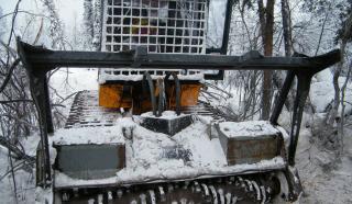
Our mulchers are track-mounted for low ground pressure allowing us to "tread lightly" — reducing rutting and ground disturbance.
Line Clearing & Mulching
Clean Harbors Mulching and Hand Cutting Services utilize the latest technology to remove underbrush safely and expertly in projects ranging from forestry to full land clearing. This makes way for new pipelines, power lines, source, and receiver lines. We pride ourselves in fully understanding the process and adjusting our methods to different climates. Clean Harbors workers have the manpower and expertise to provide high levels of efficiency.
Clean Harbors Line Clearing services provide accurate and reliable technologies for each seismic project.
Using GPS-guided equipment maximizes our efficiency and allows us to pinpoint your desired corridor within 25 meters with no continuous line of the site produced. As a result, we adhere to all low-impact seismic cutting requirements.
Our LIS system, guided by GPS, is top-of-the-line technology that works under the canopy in any forest condition providing an environmentally friendly method to cut lines with minimum impact on the land.
Clean Harbors Seismic Line Cutting services rely on safety measures to ensure regulations are followed—while meeting your seismic project expectations.
- Meandering line to block continuous line of sight.
- Low impact avoidance cutting
- Minimal ground disturbance
- Eliminating cut-line erosion
- Site Preparation and Land Clearing – Large-scale land clearing in short timeframes
- Seismic Exploration – Mulchers with GPS provide low-impact and no continuous line of site with minimal disturbance to the duff layer.
Hand Cutting Services
Clean Harbors used hand-cut line-clearing techniques to safely perform line-clearing techniques. Line cutting should be handled by professionals to avoid costly mistakes and/or negative impacts on the environment. Clean Harbors is dedicated to adhering to environmental stipulations to ensure your personnel is safe and we meet your project requirements.
Hand Cutting Benefits
- Minimize soil erosion
- Minimize stormwater runoff
- Avoid expensive reclamation costs
- Provide eco-friendly methods
Surveying, Pipeline Utility Locating and GIS Mapping

Using LiDAR survey techniques, we limit the time required to gain a survey position on the ground and can cover larger distances during the day, which allows us to work with a smaller, more efficient crew.
Our advanced technologies and expert use of geographical information and global positioning systems allow us to precisely pinpoint desired locations. Our GPS land surveying units can quickly identify locations with accuracy on the horizontal plane. Clean Harbors Surveying teams draw from over 20 years of industry experience. We have the advantage of highly trained professionals with the manpower to complete your project with efficiency.
Clean Harbors Surveying Solutions include:
- UnderCanopyGPS – software that provides accurate under-canopy GPS data collection
- GPS Survey Control – static GPS survey quality control
GIS Mapping
We can provide a wide range of GIS mapping. Using the most current software to manage and plot data, we can provide up-to-date maps for any project. Geo-referenced program data is visually represented in paper and digital maps format.

Pre-plot Mapping
- Lidar mapping is used to adjust point locations,
- Environmentally sensitive areas are identified,
- Source & Receiver points are remodeled to comply with regulated setbacks while meeting specified client requirements.
Receiver and Source Points
- Trimble GNSS receivers are used to establish and survey receiver and source points,
- Points can be moved as needed to accommodate terrain and/or environmental concerns,
- Final point locations are delivered to client representatives in various formats.
Pipeline Utility Locates
Clean Harbors Pipeline Utility Locators provide locating, GPS surveying, and GIS mapping of your underground utility and buried facility lines in advance of your ground disturbance activities. Our locators are also supported by pipeline database providers whose database searches are produced digitally and transmitted with ease.
Clean Harbors can fulfill your One-Call Management needs from start to finish while on the program including the placement of tickets, a liaison between project management and facility owner requirements, and confirmation from facility owners of locates and crossing.
Clean Harbors is experienced with Line Locating on Seismic Programs in Canada within Alberta, Saskatchewan, British Columbia and Manitoba, and in the U.S. within Pennsylvania, Colorado and Oklahoma.
- Seismic Locating
- GIS Mapping
- Crossing Inspection/Supervision
- Sign Installations
- Pipeline Integrity Programs
